Guides
Part of 3 lessons from walkable town case studies
Two days spent understanding how this walkable district was rebuilt
Two days spent understanding how a district was rebuilt: the before-and-after walk, the boundary walk, the water, and the people worth talking to on day two.
This is a two-day plan for a specific kind of visitor: someone who wants to understand a town rather than tick off its attractions. It works best in a place that has documented a rebuild, and it is more satisfying than it sounds, because a district you understand is far more interesting to walk.
What to take away
- Day one walks the project. Day two walks its edges and its water.
- Look up rather than only along. Roofs are part of the story now.
- Waterfronts are the most commonly funded public projects and the most changed.
- One conversation on day two is worth more than a third day of walking.
Day one: the project itself
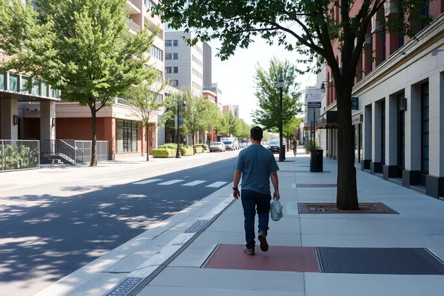
Start at the newest public space and walk out from it in a spiral. You are counting things: crossings, benches, trees, doors, bike racks, drains. It takes ninety minutes and it produces a mental map that no guidebook can.
Mid-morning, walk the same three blocks a second time and look up. Roof treatments are part of modern district design and they are invisible from a phone.
EPA's overview of green roofs describes a green roof as a vegetative layer grown on a rooftop. It provides shade, removes heat from the air and cools the roof surface and the air around it. In built environments with limited vegetation, EPA notes, green roofs can moderate conditions. Parking garages and civic buildings are where you will see them.
Spend the afternoon indoors at the local history collection, then walk the district again at golden hour. The second walk is when the counting from the morning turns into something you understand, because you now know what the buildings used to be and can see which ones were kept.
Take photographs of the plain things: a crossing, a drain, a bench, a corner. They are the record you will want later, and nobody else takes them.
Day two: the edges and the water
Morning is for the boundary. Walk to where the project stopped and keep going for three blocks. That transition tells you what the town looked like before, and it is usually the most honest twenty minutes of the visit.
Afternoon is for water. Riverfronts and creeks attract public projects, and many of them are documented. EPA lists a range of Trash Free Waters projects it has supported technically and financially to keep trash out of waterways. They include creek cleanup and prevention work, trash capture demonstrations and refill station programs in state parks.
| Half day | What you do | What you learn |
|---|---|---|
| Day one morning | Spiral walk from the newest space | What was built |
| Day one afternoon | Local history collection | What was there before |
| Day two morning | Walk the project boundary | What did not get money |
| Day two afternoon | The water and its path | How the town relates to it |
Fit one conversation in
Send an email before you travel and try to arrange twenty minutes with someone who worked on the district. Our guide to finding someone who can explain a rebuild covers who to approach and what to ask. If nobody replies, the case studies pillar covers where the written record is, which is the next best thing.