
Guides
Judging a walkable town before you book: a beginner's field guide
How to judge whether an American town is really walkable before booking, using block structure, sidewalk rules, transit links and a short field test.
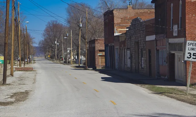
Most towns that market themselves as walkable are describing a mood: a few blocks of shopfronts, some benches, a photogenic corner. That is not the same as a place where a visitor without a car can eat, sleep and shop on foot for three days running. This guide is about telling the two apart before you pay for anything.
What to take away
- Walkability comes from the street network and the mix of uses, not from the storefronts.
- Block length and crossing frequency predict how a town feels on foot better than any review.
- Sidewalk width, slope and surface on public streets follow written federal guidelines, so you can ask specific questions instead of vague ones.
- One afternoon of map reading beforehand saves more time than a full day of wandering on arrival.
What walkable actually means
The Environmental Protection Agency's summary of smart growth principles lists creating walkable neighborhoods with mixed land uses, compact building design, and a variety of transportation choices, and they belong together.
15-Minute Walkability Test
- Breakfast spot
- Grocery store
- Pharmacy
- Transit stop
- Reason to be in town
A sidewalk running past nothing but parking goes unused. Walkability needs short blocks and buildings at the street. It also needs enough to do within a few hundred yards so walking becomes the obvious way to move between them.
For a visitor, this is a simple test. Pick your likely lodging, then count how many of these you can reach on foot in fifteen minutes: breakfast, a grocery store, a pharmacy, a transit stop, and one actual reason to be in town.
Three out of five is a working base; fewer means a driving trip with extra steps.
Read the street before you read the reviews
Satellite view answers most of the question. Blocks of roughly 200 to 400 feet give frequent corners and short detours when something is closed. Long superblocks force you onto one route and one crossing point, which is where visits go wrong.
Look at what sits between the buildings and the road. A line of parked cars and street trees usually means the sidewalk is protected. A wide shoulder with no curb means it is not.
The rules that shape the sidewalk
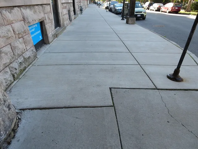
The Access Board's technical requirements for public rights-of-way set a minimum continuous clear width of 48 inches for pedestrian access routes. Where narrower, they require 60 by 60 inch passing spaces no more than 200 feet apart. Cross slope is capped at 1:48 outside crosswalks.
These rules apply to new and altered public pedestrian facilities but do not govern private homes or a hotel's own garden.
Knowing the numbers changes the question. Rather than asking whether a route is easy, ask whether the sidewalk is continuous, whether corners have ramps, and whether the surface is stable and firm.
Good sign
- Block length
- Frequent corners
- Sidewalk
- Continuous, both sides
- Crossings
- Marked, with curb ramps
Warning sign
- Block length
- One long face, no break
- Sidewalk
- Gaps, or one side only
- Crossings
- Paint and a raised curb
What beginners usually get wrong
The common error is treating the historic core as the whole town. Cores are small. Ask where the second cluster of activity sits and whether a sidewalk connects the two. The second error is underestimating grade: elevation costs more than distance, and it does not show on a flat map.
The third is budgeting as though walking were free, so read our breakdown of transport, stays and tickets first. If anyone in the group has mobility needs, start with the accessible options piece instead, since route choice has to come before booking.
Common questions
Is a walk score enough to decide?
How far will I actually walk each day?
Do the federal sidewalk rules apply everywhere?
What if a town fails the fifteen-minute test?
In this guide
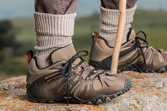
- Packing for a walkable-town trip: footwear, layering and a daypackA packing list built for eight-hour days on pavement: footwear, layering, a daypack that carries weight properly, and the sun and air checks that matter.
- Walkable towns: how to check a location with the EPA indexUse the EPA National Walkability Index and a street map to check whether a walkable-town address connects to the places you plan to reach on foot.
- Walkable towns companies: find and vet local guidesSearch “walkable towns companies” for booking sites and local groups. Check the operator, route, accessibility details, and questions to ask before booking.
- Accessible walkable towns: what public sidewalks must provide that private hosts do notWalkable towns accessible options: what US public sidewalks are required to provide, what private hosts are not, and how to plan a town visit around real features.
- How to shape a two-day walkable towns itineraryShape a two-day walkable towns itinerary: a reusable day-one loop and day-two climb, daily mileage, elevation checks and a rain plan for small-town visits.